A "compass" is a part of a treasure trail. This update was released on 4 August 2010.
When you click on the elite clue, the screen will centre north and point the direction of next clue. It only gives direction, not distance. Try teleporting to various cities to triangulate the location of the clue. Another method is to teleport to certain locations by using Fairy rings to save money and make the triangulation more precise. When you are standing in the correct location, an X will appear in the middle of the compass interface.
Note: Any of these clues can trigger a dangerous Guthix wizard. Always be prepared! Remember bringing a Meerkat familiar with the scrolls eliminates the need to kill a Guthix wizard if one spawns on the compass location.
Locations
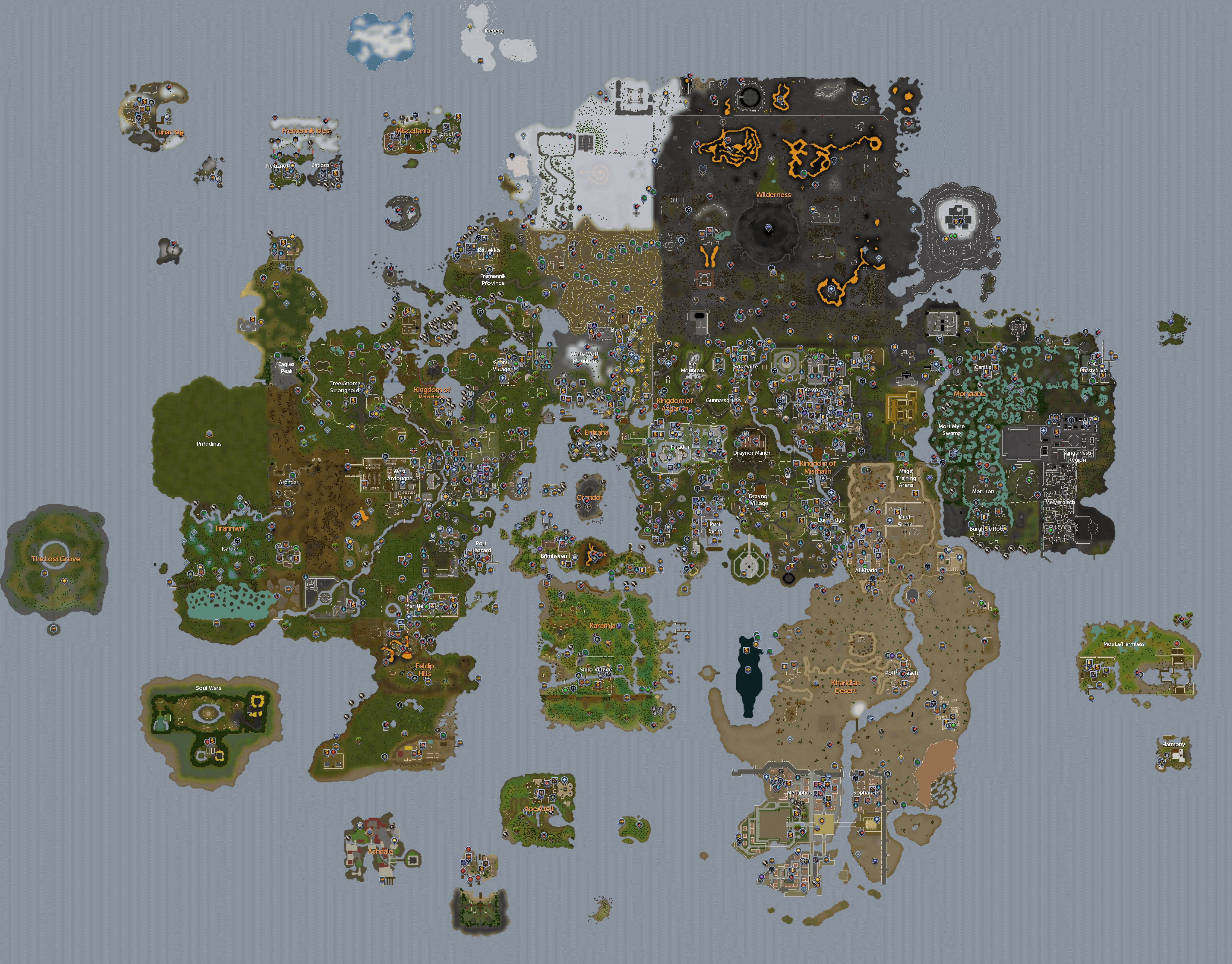
The locations in this guide are grouped by region. The following map may be useful in consultation:
Kandarin, Piscatoris and Gnome Stronghold
| Location | Image |
|---|---|
| West of Piscatoris Fishing Colony | File:Piscatoris Compass Elite clue.png |
| In the Piscatoris Hunting area between the rabbit holes | File:Piscatoris2 Compass Elite clue.jpg |
| A little bit Northwest of the entrance to Piscatoris Fishing Colony. | File:Compass Clue - South of Piscatoris.png |
| In front of the Door of the house south of the Church in Witchaven. | File:Witchaven-compass-clue.png |
| South of Piscatoris Hunter Falconer area | File:CompasClue-PiscHunter.png |
| South of Tree Gnome Stronghold bank | File:Gnome Stronghold Compass Elite Clue.png |
| Kandarin, bridge west of plague sheep.1 | File:Kandarian-clue.png |
| North-east side of White Wolf Mountain. | File:TT Compass White Wolf Mountain.png |
| Hazelmere's island - near bridge north of his hut | File:CompassClue-HazelmereIsle.png |
| In Catherby, south of Candle shop and few squares west of docs. | File:Catherby location.png |
| In Catherby, a few steps from the Obelisk of Water (Entrance by the Taverley Dungeon). | File:Obelisk of water.jpg |
| North of Yanille | File:North Yanille Compass Elite Clue.png |
| At the centre of Seer's Village | |
| And another spot in the sheep pen south-west of the Farming Patches north of Ardougne; go to the far south of the pen, hugging close to the building nearby. | |
| There is a location just west of the Gnome Maze, south of Ardougne, and slightly southeast of a fruit tree farming patch. | |
| Between the Necromancer Tower and the Ardougne Zoo, there's a spot of field that goes into water. | File:Compass south ardougne.png |
| South east of the church south of Ardougne. Next to a broken cart. | File:Kandarin Compass Clue (SEofChurch).png |
| North of Camelot Castle and southeast of Sinclair Mansion, between some trees. | File:SinclairMansionCompass.png |
| South of the combat training camp unlocked in Biohazard, north of Ardougne | File:Compass Training Camp.png |
| Just north of the Phoenix Lair | File:Phoenix Lair compass.jpg |
| Just South-West of the Church where Galahad is, near the log balance to the coal mining area west of McGrubor woods | |
| East of the Grand Tree in Tree Gnome Stronghold. At 10 degrees, 11 minutes North; 1 degree, 31 minutes East. | |
| In the middle of the tortoise pen. | File:Tortoise pen compass.jpg |
| In the mining area near the ZMI altar, just north of the hunting area. | File:ZMIaltarcompass.jpg |
| In the Khazard Battlefield | File:Khazard.JPG |
| In the graveyard near the entrance to the Ourania runecrafting altar. | File:Ourania scan location.png |
| North of the Fight Arena | File:Elite-fight-arena.JPG |
| Yanille; East of Bert the Sandman's House and west of the cooking facility. | File:Yanille Compass Clue - East of Bert.png |
| Right next to the Legend's Guild on the right side | |
| North of West Ardougne's North Wall | File:Compass Clue West Ardougne.png |
| Near the Moss Giants, blue sheep, and Warrior women. | File:Compass Moss Giants Kandarin.png |
| ooglog, behind snurgh hut | |
| Port Khazard, south of the general store |
Fremmennik area
| Location | Image |
|---|---|
| East and outside of Rellekka, west of Keldagrim Mine entrance, at treestumps. | File:Rellekka compass location.png |
| South of swaying tree in Rellekka. | File:Compass clue south of swaying tree.png |
| East of the lighthouse, across the broken bridge in the middle of the split in the road. | File:East lighthouse compass.png |
| Next to Otto Godblessed right near anvil at Barbarian Training start | File:Otto compass clue.png |
| In front of the door of the Lighthouse, north of Barbarian Outpost. | File:Lighthouse com.png |
| Just north of the Seers village bank. To access it either head south from the Rellekka Poh or east, north then west from Seers village. | File:Relleka Compass Clue (NorthofSeers).png |
|
At the start of the path to Mountain Camp, east of Rellekka, north of the musician |
File:EliteTrail-MountainCamp.png |
| Near the entrance to the ZMI altar. | File:Clue Scroll Near Ourania.png |
| On the road towards the Fremennik Provence just before the bridge with the Council Workman, and just past the Musician playing a lyre. | File:Sinclair compass.jpg |
| West of the entrance road to the Mountain Camp. | File:EliteFremmenikCompassClue.png |
| Just southeast of the Rellekka Player-Owned-House portal. | File:FremmySEPOHCompass.png |
| In the middle of the Rellekka marketplace | |
| In the Trollweiss hunter area on the west side. | File:TrollHunterCompass.png |
| South East of the Golden Apple Tree. | File:South-east-of-golden-apple-tree.png |
Wilderness
| Location | Image |
|---|---|
| Between the Slayer Tower and Fist of Guthix and north of the Limestone mine. | |
| Near the northwest corner of Daemonheim Castle. | File:Northwest Daemonheim compass.jpg |
| Level 4 Wilderness compass location, just north of the mind altar. | File:Lvl4wildycompass.png |
| Level 7 Wilderness Northeast of Lumberyard along shore. | File:Wildernesscompasslvl7.jpg |
| Level 12 Wilderness, east of Chaos Temple. | File:East of Chaos Temple.png |
| Level 13 Wilderness East of Dark Warriors Fortress. | File:Lvl13wildy.jpg |
| Level 15 Wilderness, south-east of the red salamander hunter area and south of the green dragons in the same area. | File:Level15.JPG |
| Level 18 Wilderness just south of the Wilderness Volcano's Stairs. | File:Wilderness Volcano compass.jpg |
| Level 19 Wilderness, eastern wall | |
| Level 20 Wilderness in the Southwest entrance to the Wilderness Volcano | File:20 Wilderness Compass.png |
| Level 21 Wilderness, in the Ruins west of the Bandit Camp | |
| Level 23 Wilderness, on hill west of river, overlooking Daemonheim. | |
| Level 28 Wilderness, South of the North-east Wilderness volcano entrance. On top of the cliffs. | File:Level 28 Wilderness compass.jpg |
| Level 30 Wilderness, in the bend of the ^ shaped cliff west of the Wilderness volcano. | File:Level30 Wilderness compass.jpg |
| Level 30 Wilderness, north of the Graveyard of Shadows and the Ruins. | File:Compass 30 Wilderness.jpg |
| Level 31 Wilderness, inside the Forgotten Cemetery. | File:Compas Forgotten Cemetery.png |
| Level 32 Wilderness, east of the North-west Wilderness Volcano entrance. Between the 2 pillars. | File:Level32 Wilderness compass.jpg |
| In the room in the Chaos tunnels with the mummies, next to the gargoyles. | File:Chaos tunnels compass.png |
|
Level 35 Wilderness, south-east of the Hill giants. Level 35 Wilderness, North-west of Corporeal beast lair |
File:35wildcompass.PNG |
| Level 40 Wilderness, just south of the lava maze | File:Clue555.png |
| Level 45 Wilderness, north of Red Dragon Isle at coordinates 22 deg, 22 min north and 23 deg, 35 min east. | File:Wild45.png |
| Level 46 Wilderness, just East of Demonic Ruins, South of Rogues' Castle | File:46 Wilderness Compass.png |
|
Level 47 Wilderness, east-northeast of the Lava Maze rune rocks, 2 steps north of the small volcano. |
File:Level47 Wilderness compass.jpg |
| Level 47 Wilderness, northeast of the Lava Maze at the top of a hill. | File:Compass wilderness lvl47.png |
| Level 48 Wilderness, near the Greater Demons | File:Greaters in wildy compass.PNG |
| Level 50 Wilderness, south of the Pirate's Hideout near the Wilderness fence | File:Deep wildy compass.PNG |
| Level 51 Wilderness, near the teleport lever to Ardougne. A level 110 Guthix wizard may attack. | File:Compass Ardy Lever.PNG |
| Level 54 Wilderness, on the small peninsula northeast of the Rogues' Castle, 2 paces southwest of the dead tree. | File:Level54Wilderness.jpg |
| Level 55 Wilderness, north-western most corner behind Rogues' Castle. (volcano) | File:Level 55 wilderness clue.png |
| Level 55 Wilderness, north of the Scorpion Pit. | File:ScorpPitWildyCompass.png |
| South west entrance from the Wilderness into Daemonheim. | File:Southwest Daemonheim compass.png |
| Southern Daemonheim 41 deg 56 min N, 31 deg 01 min E |
File:EliteTrail-DaemonheimSouth.png |
| Southeast of Daemonheim, near the entrance to the resource dungeon. | File:Daemonheim scan location.png |
| Along the southern rim of the Wilderness Volcano, just north of Stealing Creation | File:EliteTrail-VolcanoRim.png |
| Daemonheim - Near the stair going to the tents.16 degrees, 16 minutes north 31 degrees, 9 minutes east |
File:Compass clue Daemonheim stairs tents.png |
| Level 31 Wilderness, near the edge of the water. | File:Wilderness compass clue.png |
|
Misthalin
| Location | Image |
|---|---|
| The north east corner of the Exam Centre, by the tree. | File:Northeast exam centre compass.png |
| West of the Exam Centre, on top of the hill. | File:Exam Centre Compass Clue.png |
| In the middle of the Digsite, between some excavation areas. | File:Digsiteeliteclue.jpg |
| East of the Digsite and west of the River Salve. | File:Compass digsite east.jpg |
| Just north of the pillory in Varrock. | File:VarrockPilloryCompass.PNG |
| Northwest in the Grand Exchange. | File:GeCompass.png |
| Lumbridge, slightly North of the Caved-in Mine. | File:Compass Lumbridge.png |
| Lumbridge Swamp, east of the Water Altar. | File:Compass East Water.png |
| Lumbridge Swamp, Southeast near mine, bridge and fishing spot. | File:Compass clue-Misthalin-Southeast Lumbridge Swamp Near Mine.png |
| Potato farm north of Lumbridge cow farm. | File:Ttcompasspotato.jpg |
| North east of Draynor, inside fenced off area. | File:Misthalin Compass (NEofDraynor,wheat farm).png |
| North east of Draynor Manor. | |
| Southern part of the Lumbridge castle courtyard. | File:Misthalin Compass (LumbridgeCourtyard).png |
| There is one on the member's side of the fence, west of the beacon and east of the lumberyard. | |
| Sheep farm south of Varrock | File:Sheep farm elite clue.jpg |
| There is one just north of the River Lum (river to the north of Lumbridge). | |
| In Draynor, exactly two spaces from the witch's door. | |
| Just south of the Lumbridge cow pen amongst the trees. | File:Lumby cow clue.PNG |
| Just west of the Wizard's Tower south of Draynor Village. | File:WizardsTowerCompass.png |
| In Lumbridge, just outside of the Cemetery. | File:Lumbridge grave compass.png |
Morytania
| Location | Image |
|---|---|
| East of Ectofuntus, North of Velorina along wall | File:Ecto Morytania.jpg |
| North of the Nature Grotto in Morytania Swamp. | File:Mort Myre compass location.png |
| BKR Fairy ring in Morytania Swamp. | File:Mort-bkr-elite.png |
| Southern most road intersection in Mort'ton | File:Mort'ton Compass.png |
| Southern Mort'ton, just north of the bridge to Burgh de Rott. | File:Mort'ton Compass Clue.png |
| 3 steps west of the water pump just outside Barrows | File:Compass Barrows.png |
| Haunted Woods Southwest of Fairy Ring ALQ | File:Morytania East of Canifis Compass.png |
| On the ground floor of the Slayer Tower, in the Crawling Hands room | File:Slayer tower compass.jpg |
| On the ground floor of the Slayer Tower, in the Crawling Hands room | File:Slayer tower compass2.jpg |
| Hunter area in Morytania, at 9 degrees, 0 minutes north and 34 deg, 18 minutes east. | File:MoryHuntAreaCompassClue.png |
| Just outside the North-West Corner of Burgh-de-Rott, NW of the general store. Note: this is NOT inside the city, it is just outside the wall. | File:Burghderottcompass.jpg |
| Just west of the shipwreck north of the farming patches. | |
| On the east side of the swamp path leading into Mort'ton | |
| On the west side of the swamp path leading to Mort'ton, south of the musician. | |
| In the middle of Canifis, between the quest start point and the Tannery. | File:Canifiseliteclue.png |
| Slightly Southeast of Canifis Bank (behind bank), near water edge. | File:Canifisbankclue.png |
|
Just southwest of The Hollows boat to Mort'ton. Between the plants and the swamp water. |
File:Southofhollows.png |
|
Just outside the entrance to barrows, northeast of barrows walls. |
File:Compass location.png |
Asgarnia
- North of the Warrior Guild
- Just south of the wall between Taverley and Falador.
- Between the Falador chainmail shop and the spinning wheel (south of the castle)
Karamja
| Location | Image |
|---|---|
| Tai Bwo Wannai Village, Karamja. | File:EliteTaiBoWannaiCompassClue.png |
| South of Log crossing Karamja River. | File:Compasskaramja.png |
| East of Shilo Village. | File:Shilo village clue.jpg |
| Karamja, near Jogre dungeon entrance. | File:Treasure Trail Karamja Jogre.jpg |
| Karamja, on the island with moss giants. | File:Mossgiantislandcompassclue.png |
| Brimhaven, north of Brimhaven Dungeon entrance | File:North Brimhaven Dungeon compass.png |
| Directly west from Shilo village on the far western side of the island, 2 steps south of a crate. | File:IPEliteWestShilo.png |
| Slightly to the south of the General Store at Karamja, south of the Plantation | |
| Between the summoning obelisk on Karamja volcano and Stiles.0 degrees, 15 minutes south 12 degrees, 35 east |
File:Compass clue Karamja volcano obelisk.png |
| Slightly north of nature altar. | File:Nature altar compass.png |
Just north of the glider captain.
Just slightly north of the agility arena and east of the farming patch.
Feldip Hills
| Location | Image |
|---|---|
| Feldip Hills Compass location, just east of the fairy ring and by the lake. | File:Feldipcompass.png |
| Feldip Hunter area compass location, next to the tree just south west of the shack, under the tree. | File:Feldiphuntercompass.png |
| Feldip Hills, chompy hunting area west of Castle Wars | File:EliteTrail-FeldipCastleWars.png |
| Feldip Hills, north-west hunting area, north of the cave just west of the Hunting expert | File:EliteTrails-FeldipHuntingExpert.png |
| Behind of mobilising armies. | File:Elite clue M.A south.png |
| Just north of mobilising armies command centre. | File:North mobilising armies compass.jpg |
| East of the Feldip Hills hunter area, near the Red Chinchompas | File:Elite-chinchompas.jpg |
| Inside Oo'glog, south of Snurgh | File:Ooglogscanlocation.png |
Desert
- One can also be found near a cactus just to the east of the Bedabin Camp
- 3 steps west of DLQ fairy ring, near the desert lizards
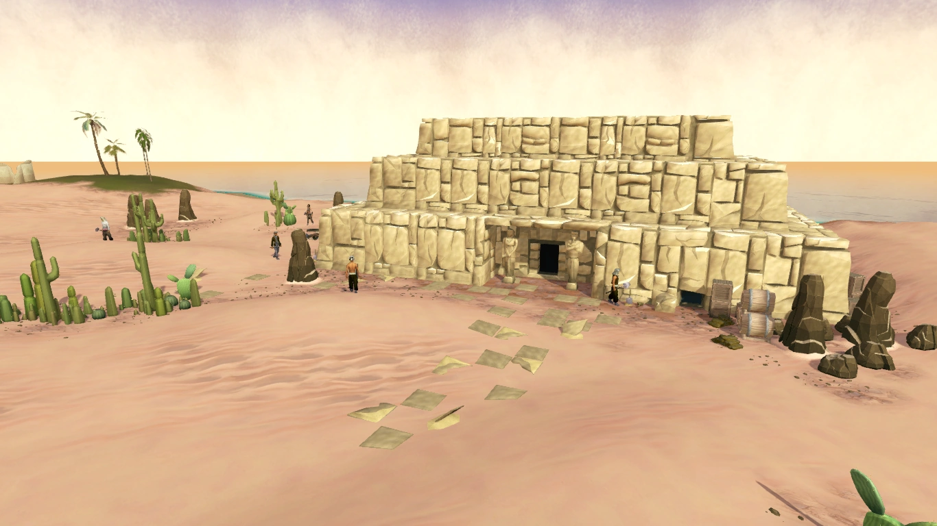
- Infront of the Cave near the Desert Phoenix.
- East in the middle of the building involved in Missing My Mummy (East Desert opposite Mos Le'Harmless
.png)
.png)
_-_Level_21_Wilderness.png)
.png)
.png)
.png)
.png)
.png)
There are many other spots as well. Pictures are not available yet for these places.
Trivia
- When inside of a Player-owned house, on a boat, in Zanaris, or inside any dungeon the compass will just spin in circles.